A Synopsis or Abstract of Website Content
The author has lived for over 70 years on the farm 'Rotokare', which includes the main 'Oueroa pa' and a good portion of the catchment area and lake-bed of 'Lake Te Rotokare'. All are situated 12 kilometres south-west of the Napier City center, Hawkes Bay, New Zealand.
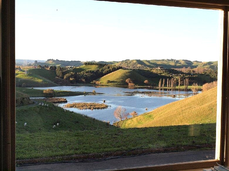
LAKE TE ROTOKARE
The lake is a 'catchment' or ponding 'basin' with no continual flow of water into, nor out of it. It survives primarily on rainwater run-off that enters from the ground surface and by a flow or seepage off the underlying clay pan on the surrounding hills in the weeks or months following rain.
Being seasonally charged in this manner it fluctuates yearly with high and low levels. It is a true "EPHEMERAL WETLAND", a concept that the inexperienced in nature, although maybe intellectial in qualifications, can not easily understand! And this ignorance is a good part of why the local Regional Council is found to be implicit in the destruction of this te-Rotokare wetland.
The Council have been forever (it seems) intent on digging and deepening a channel that allows natural catchment waters to flow from the lake, against the natural course of nature. They ignore landowners plea's against this destruction, opting to pursue instead works based upon supposed financial rewards, other personal interests and laws that are not in the interest of the environment. A crazy situation when they profess they are 'protecting the environment', and yet are openly found to be destroying it! Intellect and natural environment do not mix, and this is a good example of it. It is hard not to let the presention or spirit of these web pages be influenced by these past actions.
OUEROA PA
The pa Oueroa at the head of the lake includes the associated earth formations which are still very obvious, these are also found on ridges close to and surrounding the lake as are other items of archaeological interest.
The most direct lineage of many Ngati Kahungunu descendants today originated at Oueroa over four centuries ago. The pa and people are obviously intimately associated with the lake and surrounding land, and yet there is an even deeper history unfolding as will be seen.
I sincerely believe that the Heritage Value combination of Oueroa and lake Te Rotokare is far too important to be tampered with, and that the catchment diversion situation be reversed. At the moment water that should be entering the lake is being diverted because of inaction, and there is absolutely no sense in allowing this.
With regards Oueroa, a positive step was taken in March 2017 when the Queen Elizabeth II National Trust approved that 28.5 hectares (71 acres) of a large section of the main Oueroa pa and surrounding associated land be protected under an Open Space Covenant. This was finalised in 2018 and is known as the 'Oueroa Open Space Covenant 5-05-319'. A further (as yet uncovenanted) area of Oueroa is on an adjoining neighboring property.
This website is will give a small amount of history on the area, and hopefully show a picture of how it all fits together; this most important little valley and surrounds, which has often been referred to the most historic area in the Hawke's Bay.
G.W. (April 12 2021)
[The Rotokare story is quite extensive, but it starts here with the lake, giving a brief historic introduction of lake levels and drainage attempts up to the present day. Other non-lake items of interest are mentioned because they form a part of the larger story not yet in writing].
AN EARLY EVENING VIEW FROM MY FRONT WINDOW